School Options
Life is not a one-size-fits-all journey, and neither is school for our students. That’s why KUSD offers families a variety of schools to meet the needs of all learners in grades 4K-12. Each student is assigned to a boundary school based on their address, but families also have the opportunity each year to apply to any of KUSD’s choice schools.
BOUNDARY SCHOOLS
Boundary schools are assigned based on a student’s home address – find yours using the boundary school locator tool.
Families who plan to attend their assigned boundary school should complete the annual registration process. Registration for boundary schools opens mid-February each year.
CHOICE SCHOOLS
Choice schools are KUSD schools other than a student’s boundary school to which families may apply to attend.
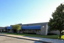
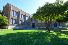
Elementary Schools
Bose Elementary
1900 15th St. Kenosha, WI 53140
Phone: 262-359-4044
Principal: Susan Mozinski
Hours: 8:05 a.m. – 3:11 p.m.
Brass Community School
6400 15th Ave. Kenosha, WI 53143
Phone: 262-359-8000
Principal: Joel Kaufmann
Hours: 8:55 a.m. – 4:01 p.m.
Curtis A. Strange Elementary
5414 49th Ave. Kenosha, WI 53144
Phone: 262-359-6024
Principal: Yolanda Jackson
Hours: 7:20 a.m. – 2:26 p.m.
Forest Park Elementary
6810 45th Ave. Kenosha, WI 53142
Phone: 262-359-6319
Principal: Taylor Schmit
Hours: 8:05 a.m. – 3:11 p.m.
Frank Elementary
1816 57th St. Kenosha, WI 53140
Phone: 262-359-6324
Principal: Erik Schlick
Hours: 8:00 a.m. – 3:08 p.m.

Grant Elementary
1716 35th St. Kenosha, WI 53140
Phone: 262-359-6346
Principal: Leah Whitford
Hours: 8:05 a.m. – 3:11 p.m.
Grewenow Elementary
7714 20th Ave. Kenosha, WI 53143
Phone: 262-359-6362
Principal: Jennifer Folkers
Hours: 7:20 a.m. – 2:26 p.m.
Harvey Elementary
2012 19th Ave. Kenosha, WI 53140
Phone: 262-359-4040
Principal: Ursula Hamilton-Perry
Hours: 7:20 a.m. – 2:26 p.m.
Jeffery Elementary
4011 87th St. Kenosha, WI 53142
Phone: 262-359-2100
Principal: Kurt Johnson
Hours: 7:20 a.m. – 2:26 p.m.
Nash Elementary
6801 99th Ave. Kenosha, WI 53142
Phone: 262-359-3500
Principal: Brett Basley
Hours: 8:05 a.m. – 3:11 p.m.
Pleasant Prairie Elementary
9208 Wilmot Rd. Pleasant Prairie, WI 53158
Phone: 262-359-2104
Principal: Amy Shepherd
Hours: 8:55 a.m. – 4:01 p.m.
Prairie Lane Elementary
10717 47th Ave. Pleasant Prairie, WI 53158
Phone: 262-359-3600
Principal: Camille Schroeder
Hours: 8:55 a.m. – 4:01 p.m.
Roosevelt Elementary
3322 Roosevelt Rd. Kenosha, WI 53142
Phone: 262-359-6097
Principal: Duane Sturino
Hours: 8:05 a.m. – 3:11 p.m.
Somers Elementary
1245 72nd Ave. Kenosha, WI 53144
Phone: 262-359-3200
Principal: April Nelson
Hours: 7:20 a.m. – 2:26 p.m.
Southport Elementary
723 76th St. Kenosha, WI 53143
Phone: 262-359-6309
Principal: Julie Cholak
Hours: 8:05 a.m. – 3:11 p.m.
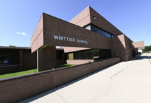
Whittier Elementary
8542 Cooper Rd. Pleasant Prairie, WI 53158
Phone: 262-359-2110
Principal: Mark Dzioba
Hours: 7:20 a.m. – 2:26 p.m.
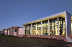
Middle Schools
Bullen Middle School
2804 39th Ave. Kenosha, WI 53144
Phone: 262-359-4460
Principal: Matt St. Martin
Hours: 8:40 a.m. – 4:00 p.m.
Lance Middle School
4515 80th St. Kenosha, WI 53142
Phone: 262-359-2240
Principal: Chad Dahlk
Hours: 8:40 a.m. – 4:00 p.m.
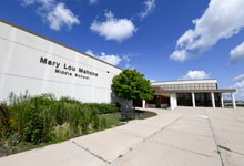
Mahone Middle School
6900 60th St. Kenosha, WI 53144
Phone: 262-359-8100
Principal: Steve Germain
Hours: 8:40 a.m. – 4:00 p.m.
Washington Middle School
2600 50th St. Kenosha, WI 53140
Phone: 262-359-6291
Principal: Shane Gayle
Hours: 8:40 a.m. – 4:00 p.m.
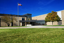
High Schools
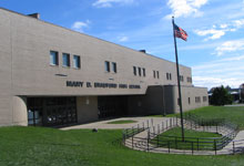
Bradford High School
3700 Washington Rd. Kenosha, WI 53144
Phone: 262-359-6200
Principal: JJ Kotarak
Hours: 7:20 a.m. – 2:51 p.m.
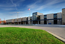
Indian Trail High School and Academy
6800 60th St. Kenosha, WI 53144
Phone: 262-359-8700
Principal: Scott Kennow
Hours: 7:20 a.m. – 2:51 p.m.
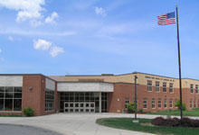
Tremper High School
8560 26th Ave. Kenosha, WI 53143
Phone: 262-359-2200
Principal: Steven Knecht
Hours: 7:20 a.m. – 2:51 p.m.
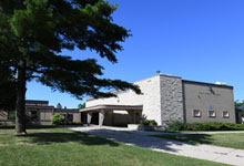
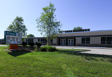
Choice Schools

Chavez Learning Station
6300 27th Ave. Kenosha, WI 53143
Phone: 262-359-6080
Principal: Rhonda Lopez
Hours: 8:00 a.m. – 3:30 p.m.
Harborside Academy
913 57th St. Kenosha, WI 53140
Phone: 262-359-8400
Principal: Trent Barnhart
Hours: 7:27 a.m. – 2:35 p.m.
Kenosha School of Language
6315 67th St. Kenosha, WI 53142
Phone: 262-359-2006
Principal: Barbara Sanchez
Hours: 8:05 a.m. – 3:11 p.m.
LakeView K-8 Academy
6729 18th Ave. Kenosha, WI 53144
Phone: 262-359-2746
Principal: Jason Creel
Hours: 8:00 a.m. – 3:08 p.m.
LakeView Technology Academy
5533 26th Ave. Kenosha, WI 53140
Phone: 262-359-8155
Principal: Bethany Ormseth
Hours: 7:15 a.m. – 2:32 p.m.
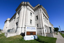
Reuther Central High School
913 57th St. Kenosha, WI 53140
Phone: 262-359-6160
Principal: Kim Fischer
Hours: 7:45 a.m. – 3:27 p.m.
Ruth Harman Academy
8518 22nd Ave. Kenosha, WI 53143
Phone: 262-359-2191
Principal: Gina Greil
Hours: 8:00 a.m. – 3:23 p.m.
Specialty Schools
Hillcrest School
4520 33rd Ave. Kenosha, WI 53144
Phone: 262-359-6118
Principal: Eitan Benzaquen
Hours: 8:45 a.m. – 1:45 p.m.
Programs

Early Childhood
8518 22nd Ave. Kenosha, WI 53143
Phone: 262-359-8901
Coordinator: Elisabeth Bischoff


District Office
John J. Hosmanek Educational Support Center
3600 52nd St. Kenosha, WI 53144
Phone: 262-359-6300
Hours: 7:30 a.m. – 4:30 p.m.